1 - Anglade car park (795m)
The starting point of the trail is above the building at the entrance to the parking lot. Take the path on the left, towards Frechendech (west).
2 - Frechendech (830m)
Leave the parking lot below, and continue straight on the path which is well marked, left bank of the Izard stream. After 30 minutes of walking, the path descends towards the river and crosses a footbridge (880m). Continue on the path which rises above the gorges, and continues on a balcony, on the right bank of the stream.
3 - Piches footbridge (1105m)
Leave the GRP path on your right by which you will come back. Without crossing the footbridge, continue straight ahead, on the path that is still perfectly marked. At around 1220m, ford a small stream. A little further on, follow the signs towards the Araing pond. The trail continues winding while climbing, and continues on the right, slightly downhill (southwest). You arrive at the end of the forest. The path rises in the grass to quickly reach the Illau hut.
4 - Illau hut (1490m)
The path climbs to the south-east for 50m of vertical drop, then crosses to the right (south). Pass quickly through the woods again, then ford a small stream. The trail continues to rise among the pebbles (southwest). A final jump takes you to a collar, facing the Araing pond dam. You will find the GR10 there (red and white markings).
5 - Junction of the GR10 (1900m)
Take the GR10 path on the right, following the red and white markings (west). The path passes under the dam, then climbs slowly to the refuge.
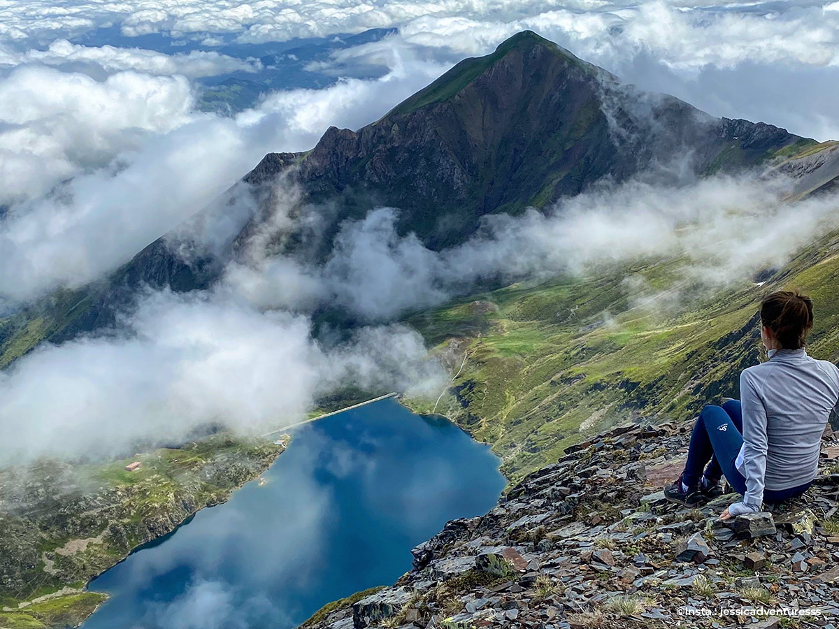
6 - Araing pond refuge / Jacques Husson (1965m)
On the right, after leaving the refuge, follow the marked red and white path of the GR10. Leave the lake below on your left (west). The path climbs steadily to lead you without difficulty to the Auéran pass.
7 - Col d'Auéran (2176m)
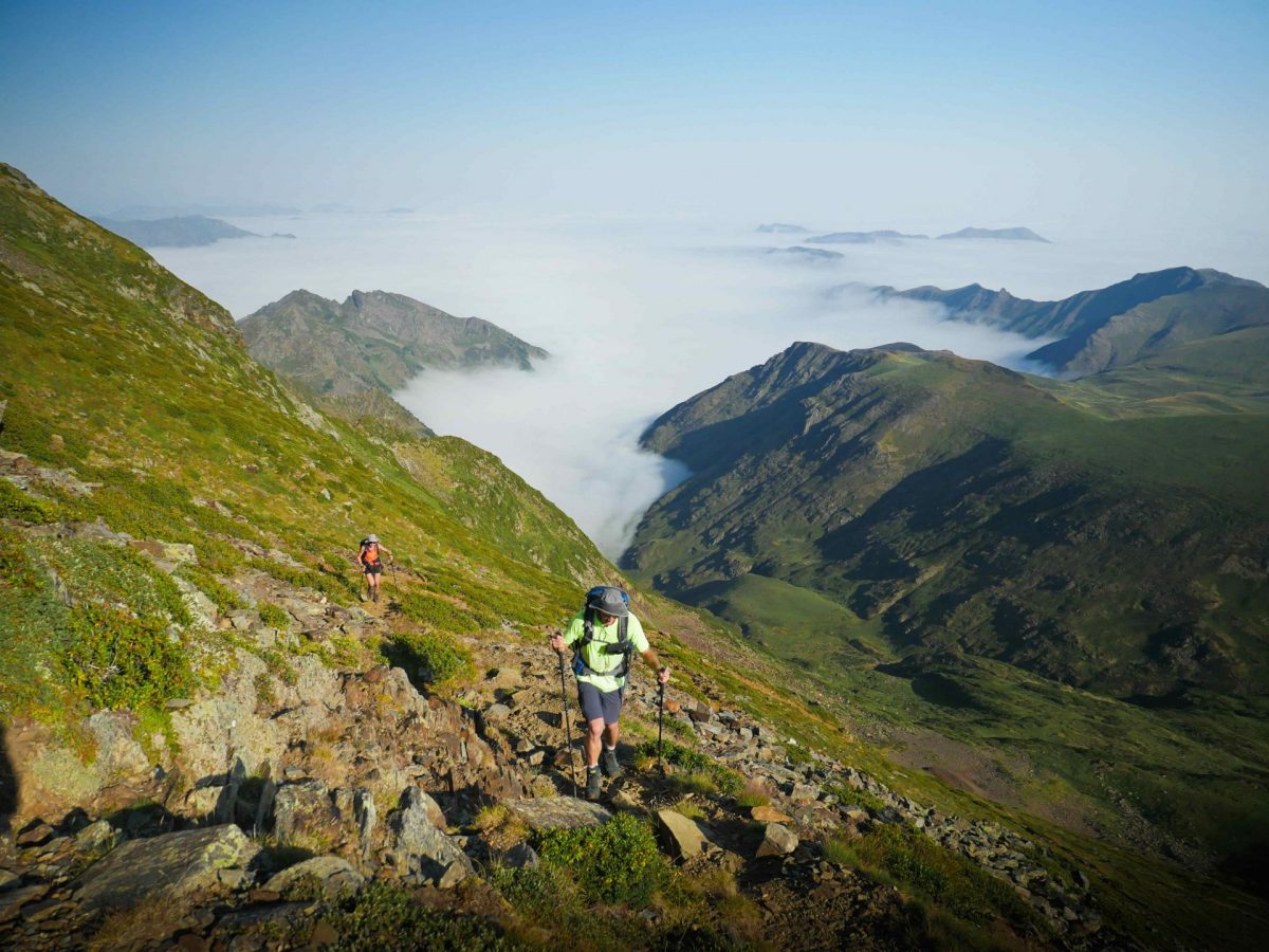
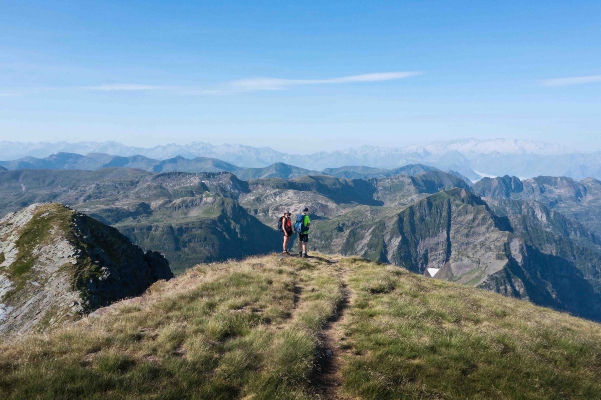
Continue to the left on a wide ridge towards the summit. Always stay at the top of the ridge, maintaining the view on both sides. After 20mn of walking, around 2300m, leave the ridge to follow a path that winds up on the north face of Crabère. The well marked path allows you to easily tackle this hard climb.
8 - Pic de Crabère (2630m)
Return by the same route to the Auéran pass.
9 - Col d'Auéran (2176m)
Follow the GR10 to the left (red and white markings), crossing the southwest slope of the tuc du Bouc (north-west direction). After 15mn, pass the western ridge of the tuc du Bouc at the level of the col le pas du Bouc (2170m). Continue on the GR, descending into the valley on a well-marked path (north-west). Leave the buildings of the old mines below on the left. Further on you reach the bottom of a valley. Cross the stream and continue flat for about a hundred meters, until the junction which is not very visible.
10 - Bifurcation - end of the GR10 (1930m)
Leave the GR to go up on the left following this small path (northeast) ... or simply go off-trail if you cannot find the path, keeping a northeast direction, on easy slopes . After quickly gaining 30m of vertical drop, you will find an unmarked but clearly visible path. Follow it on the left crossing (north-west). This path bypasses the peak of Piele de Mil, and joins the Col d'Auarde in the northeast.
11 - Col d'Auarde (1954m)
Continue opposite by following the unmarked but clearly visible path. The path descends on the right bank of the valley, deviating a little from the thalweg (east). At the bottom, the path turns a little to the left to go straight to the Pugues hut.
12 - Pugues hut (1760m)
Cross the stream under the hut, then find a path on the other side. Follow it to the right (east). At the crossroads, take the left-hand branches, slightly sloping. The trail heads above the forest and ends up reaching the Troumas hut.
13 - Troumas hut (1492m)
Go down to the right, following a lightly marked path across the meadow (southwest). At around 1420m, the path turns to the right to reach the forest hut of Isard. In front of the forest hut, follow the path to the left. Without crossing the footbridge, the path continues to the left, slightly downhill through the woods. When you leave the forest, you will discover the chapel of the Izard.
14 - Chapel of the Izard (1320m)
Continue straight on the good path of the GRP Tour du Biros. The path descends through the woods and gradually reaches the talweg where the Izard stream flows.
15 - Piches footbridge (1105m)
Cross the footbridge, and continue to the left on the path taken on the outward journey.
16 - Anglade car park (795m)
Anglade car park