Montcalm and Pique d’Estats

Elevation 2047 D +

Distance 17 km

  • Departure 09220 Auzat
  • LOOP
  • Beacon(s) BALISE
The Montcalm is symbolic because it is known as the first 3000 of the Pyrenees coming from the Mediterranean, as for the Pique d'Estats it is the highest point in Catalonia which explains why these two summits are essential in the Pyrenees
Montcalm and Pique d’Estats
Montcalm © Augustin Lespinet - Ariège Pyrenees Tourism

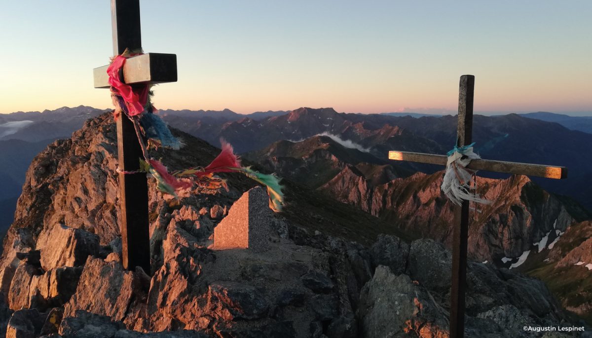
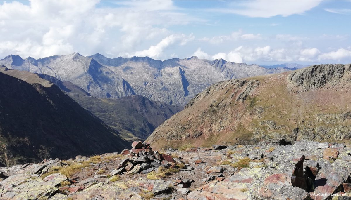
The Montcalm is symbolic because known as the first 3000 in the Pyrenees coming from the Mediterranean, as for the Pique d'Estats it is the highest point in Catalonia which explains why these two peaks are essential in the Pyrenees.
Access to start: Park in the Artigue car park.

Ranking & labels

  • Registered with the PDIPR

Location

Ariège Pyrenees

South of Ariège, on the border with Andorra, are the Ariège Pyrenees. Between mountainous landscapes and activities, there are many [...]

Learn More

Equipments & services

Equipments

  • Parking
  • Free parking

Services

  • Pet Friendly
  • Hosting
  • Catering

This provider also offers

Pinet Hut

Refuge

Heard

Your itinerary

Map List
Download
Download kml
1

Artigue car park

2

Branch to Sourd Pond

3

Deaf Pond

4

Refuge and Pond of Pinet

5

Etang d'Estats

6

Montcalm pond

7

Montcalm Pass

8

Collet d'Estats

9

Montcalm Pass

10

Peak of Verdaguer

11

Montcalm Pass

12

Montcalm peak

13

First fireplace

14

Grassy patch

15

Montcalm Tables Pond

16

Exit the corridor

17

Orris of Pla-Subra

18

Orris of Pujol-le Haut

19

Montcalm chalet

1 - Artigue car park

Head south-east and follow the marked path towards the Refuge du Pinet. Quickly leave the path on your right that leads to the Port de l'Artigue, then cross the torrent on a footbridge and continue to the left at the next junction. About 800m further on, leave the Orris de Pujol trail on your left. The path slowly leaves the forest to reach an alp with an extraordinary viewpoint over the Bassiès massif to the north.

2 - Branch to the Sourd pond

Arrived at the junction, leave on your right the path going up directly to the Refuge du Pinet and turn off on your left in the direction of the Étang Sourd.

3 - Deaf Pond

When you get to the pond, walk along it to the right until you reach the hut from where the path starts in the direction of Le Pinet and continue to the refuge.

4 - Refuge and Pond of Pinet

Once at the Refuge du Pinet, head south and follow the path to the left towards the Etang d'Estats (2420m): you can bivouac on grassy pitches.

5 - Etang d'Estats

Continue to the Etang du Montcalm.

6 - Montcalm pond

Follow the well-marked marked path that passes several rocky bars. You are gradually gaining height! At the crossroads of the trails, turn left to reach the Col du Montcalm (2970m).

7 - Montcalm pass

From this pass, take the well-marked path to the right which leads to the crest and a small pass below the Pique d'Estats (3100m).

8 - Collet d'Estats

Turn left to join the Pique d'Estats. You have about 40m of vertical drop left where you have to put your hands but no place is very aerial.

9 - Montcalm pass

On the narrow ridge are a number of crosses and plaques symbolizing Catalonia. The panorama covers all the surrounding massifs of Ariège (Bassiès, Fourcat, Valier ...), Spain and Andorra! Go back down to the small pass.

10 - Peak of Verdaguer

Arrived at the pass, continue on the ridge opposite to arrive at the Pic de Verdaguer (3129m) in 5 minutes.

11 - Montcalm pass

Continue straight on the ridge to reach the summit of Montcalm (3077m). You can admire the magnificent view of the Estats opposite.

12 - Peak of Montcalm

From this point, we decided to go back down through the Tables du Montcalm. This impressive route can prove to be dangerous in certain passages and it is strongly advised for the uninitiated to take the ascent route. To take the path via the Tables du Montcalm, you have to follow the cairns to dive slowly on the other side of the dome.

13 - First fireplace

From there you can see the valley of Pla-Subra below. This fireplace is about 100m high, the stone is very unstable and crumbles easily. You have to put your hands down in de-escalation.

14 - Grassy patch

Orient yourself to the South-East to dive to the right of a large cairn in the middle of a narrow scree corridor very steep and exposed to rock falls. It leads to a large flat area where we find the Tables du Montcalm pond.

15 - Montcalm Tables pond

Stay well at the top of the spillway and walk along the small ridge to the east, not going down too much towards the stream. There are some delicate passages (rocks where you have to put your hands) you have to follow the cairns as much as possible to arrive on a new grassy patch.
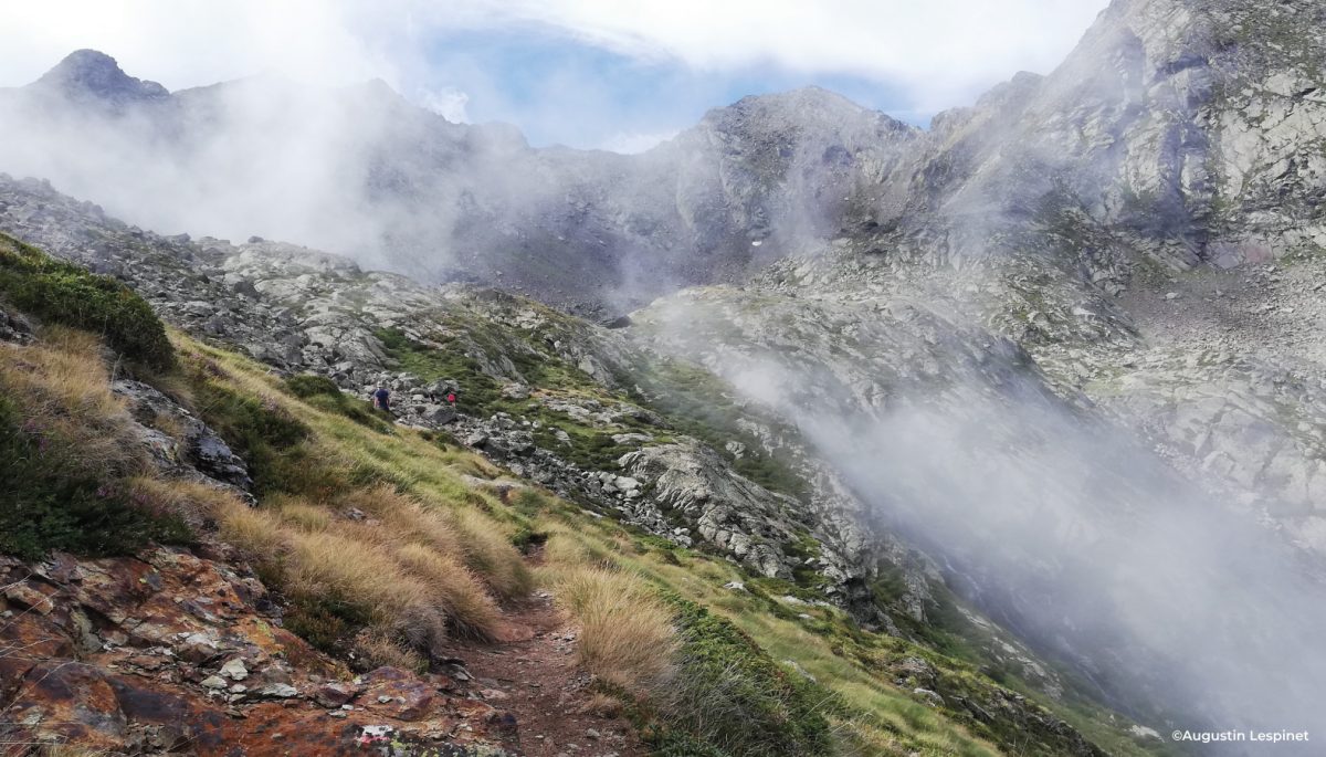
On your right plunges a grassy corridor (more accessible than the rock) that you have to continue to the bottom. The rocks are unstable but it is difficult to take the wrong route as the corridor seems obvious and the cairns visible at the bottom.

16 - Exit the corridor

From there the path is better marked and begins a gentle descent on the side of the slope to the Jasse de Pla-Subra.

17 - Orris of Pla-Subra

Continue on the path that turns north and join the Orris de Pujol.

18 - Orris of Pujol-le Haut

The trail continues to the forest road and crosses it several times in order to cut the switchbacks. Pay attention to the trailheads to cut this trail. Join the Route de l'Artigue at the Chalet du Montcalm.

19 - Montcalm chalet

Follow the road to the left to return to the starting car park.