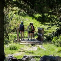
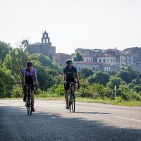


The great crossing of the Pyrenees (GR®10), from the Atlantic (Hendaye) to the Mediterranean (Banyuls-sur-mer), is one of the most beautiful itineraries in France, as the variety of landscapes is surprising and remarkable. As trying as it is unforgettable, the GR10, lasting from 45 to 60 days is an invitation to travel, to discover the most beautiful points of view, the most beautiful valleys and villages of the Pyrenees.
- Total distance: 920 km
- Estimated time: 45 to 60 days (on average 55 days)
- 55m of D + and D-
- Departure: Hendaye (64) / Arrival: Banyuls-Sur-Mer (66)
- Markings: red and white
- Difficulty level: 4/5. You have a good physical condition and are prepared for hiking over several days in the mountains or in the high mountains.
Good to know 👍
The section that goes up to the Fourcat refuge from the right bank of the Izourt pond will now be reclassified as " Access GR10 ". You will therefore no longer see the GR10 signage but the path does exist 😉 And it would be a shame to deprive yourself of the view that the arrival at the refuge will offer you! The section is mapped in black dotted lines on the IGN maps. The trail remains visible on SCAN 50 scale hiking apps.
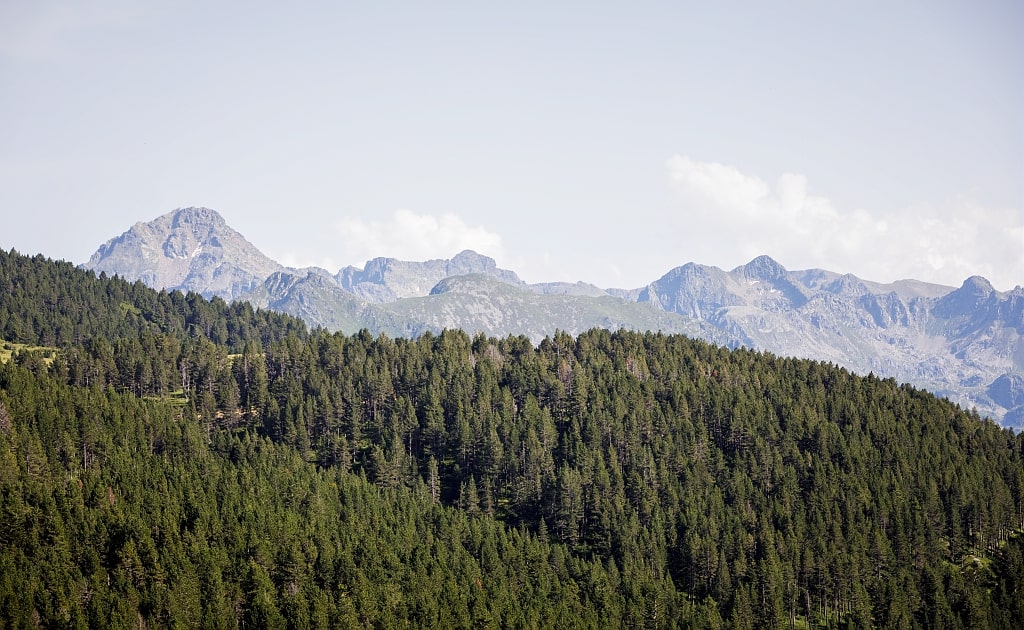
The Ariège which covers 25% of the GR10 is the reputed part the wildest, the most isolated, the one that needs to be autonomous. But isn't that what makes its charm? From Fos in Haute-Garonne, the route winds through the forest, from huts to huts, before arriving here, in Ariège, where the border ridge culminates at 3143m with the Pique d'Estats and where the reliefs are cut by deep valleys.
The GR10 is a breadcrumb trail which connects the villages of our mountains, to meet populations, to discover Pyrenean flora and fauna and all that forges the identity of our beautiful Ariège Pyrenees.
to prepare your trip
- Topoguide "Crossing the Ariège Pyrenees and tours of Val Garbet and Biros" (updated in 2016) - Edition FFRP
- Le routes and stages with GPX tracks
- Le "GR10.FR" website
Topography and specificities of the GR10 in Ariège
From Bagnères-de-Luchon (Haute-Garonne) to Aulus-les-Bains first, then from Aulus-les-bains to Mérens-les-Vals, secondly, the GR10 crosses the Ariège, before leave it to reach the Pyrénées Orientales, the Carlit massif and the Bouillouses lakes.
The Ariège part is the one that needs to be the best organized, providing for several days of autonomy in water and food, and at night in a cabin or tent. You can also plan transfers by taxis.
The diversity of landscapes
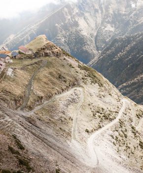
From the entire Pyrenees chain, it is in Ariège that the hiker will have the chance to observe such a wide variety of decors. The pond and the refuge of Araing, gateway to the GR10 in Ariège, announce the color: green! At the heart of the Ariège Pyrenees Natural Park, we understand from this stage that it is a lush nature, preserved, and almost unexplored which will accompany us for nearly 10 days.
From the first kilometers, the history of Ariège is revealed: the mines of Bentaillou, in the valley Biros, are the witness of an avant-garde and flourishing industrial past. The mines were among the first lead mines in France at their peak in the XNUMXth century.
Other mines and quarries to see along the GR10
- Bulard Mines
- Salau mines (tungsene)
- Balacet marble quarries
- Former extraction wells in Argentières
Going down, the village ofEylie from above at 990m is revealed: cute little barns of character, called barns "no bird", on the mountainside, with incomparable charm!
Old railway tracks, mines, dot the landscape for more kilometers, then replaced by shepherds' huts, passes and ponds.
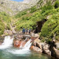
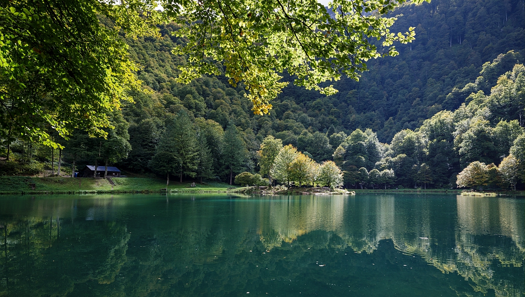
Bethmale Lake, Col de la Core, the valleys roam in the cool of the forests, skirting the streams of esbints and estours to join the Valier Reserve and come around the summit of the same name, and finally join the Ustou sector, where water is queen. Garbet pond, Cascade d'Ars, it is abundant, generous and offers breathtaking scenes.
Respect for the environment and diversity of species
Hiking rhymes with respect for the environment and observation of fauna and flora. On the route, many species will catch your eye, but be careful, picking them is prohibited! You will come across Columbines, Asphodels, Pyrenean Irises or wild Orchids!
Do not disturb the wildlife and observe it carefully. If you are discreet, you may be lucky enough to meet ibex, deer, chamois, marmots!
Walking on the marked trails seems to be obvious, but any reminder is worth taking: to protect the ecosystem, you have to walk on the trails ☺
By joining the Port of Saleix, then the port of Bassiès, one cannot but be amazed at the splendor offered by the viewpoint on the Bassiès ponds, towards which the route continues.
The most beautiful lakes of the GR10
- Pond of Araing
- Ayes pond
- Bethmale Lake
- Pond of Bassiès
- Izourt pond
- Pond of Besines
That's it, it's the entrance to the valley of Vicdessos! Rocky, it will lead to the discovery of many canyons like that of Artigue or Marc, ponds like that of Izourt to then go up towards the wildest part and join the famous beille tray.
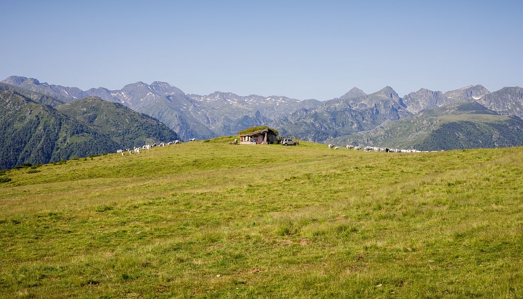
Both pastoral and tourist area, the Beille platter is surely one of the most famous and popular spots in Ariège. And for good reason ! Overlooking the valleys surrounding, it offers a breathtaking view of the most beautiful peaks, while offering a preserved area ideal for family walks and outdoor activities (both in summer and winter).
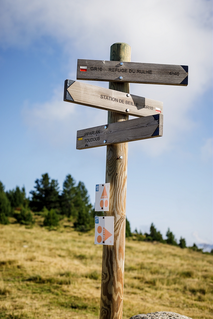
The continuation of the GR10 begins in the valley which leads to the refuge of Rulhe via the Col des Finestres and Didorte. From the refuge, the Rulhe peak imposes itself in front of us, and we see, in clear weather, the ponds of Fontargente to the south.

Rulhe Refuge
Aston - Refuge

Stopover and Stay Gite La Colline Verte
used – Stopover/stay gite
The most beautiful views of the GR10
- Guzet
- Pause Pass
- The Core Pass
- The port of Bassiès
- The pla de Montcamp
- The Beille plateau

The route continues to Mérens-les-vals, the end of the Ariège part, since it continues above the refuge and the Besines pond towards the Eastern Pyrenees, Lake Lanoux, the Bouillouses and Carlit sector.